Garmin GPSMAP 79sc
8.0Editor score2.6-inch color display
BlueChart g3 coastal
Floats in water
20-hour battery
Find the right marine gps for 2026. We compare 10 standout options by build quality, useful features, owner feedback, value, and everyday trade-offs.
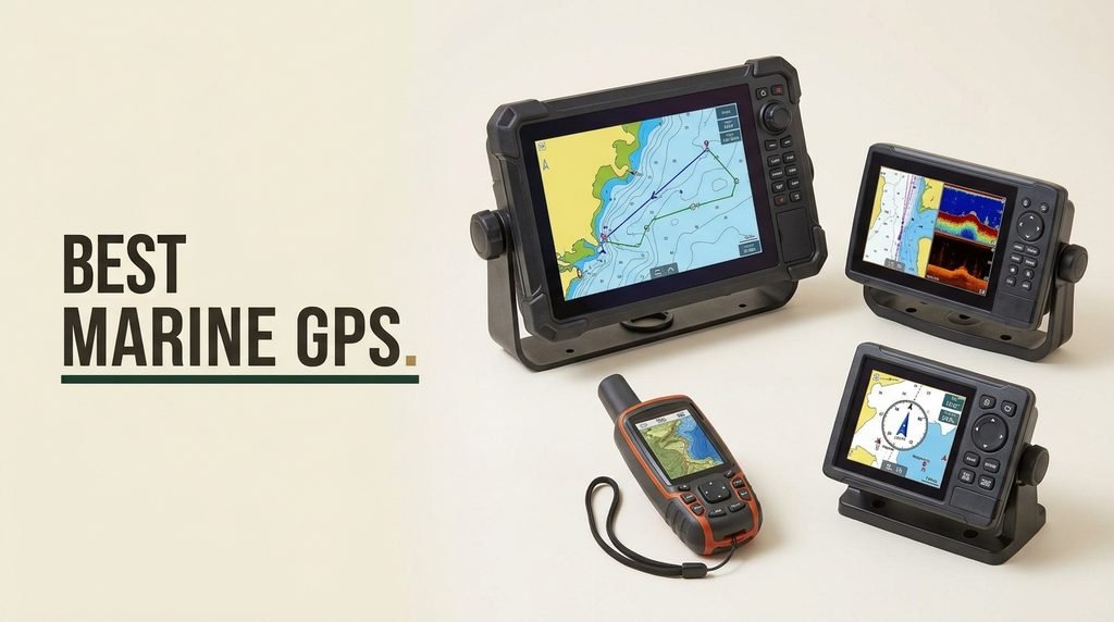
Find the right marine GPS for 2026. We compare 10 standout options by the factors that genuinely matter on the water: display size and resolution, GPS accuracy and satellite constellations, water resistance and floatability, battery life, preloaded chart coverage, connectivity options, durability, and the practical trade-offs between handheld portability and fixed-mount performance for different boating needs.
Marine GPS units range from compact handhelds to full-featured chartplotters with sonar. The biggest differences are in display size, whether they float, preloaded chart regions, satellite constellation support, and integration with other marine electronics. Some models focus on pure navigation, while others combine GPS with fish-finding capabilities and even satellite communication.
This guide breaks down each option by use case, from kayak fishing to offshore navigation. Use the comparison table and detailed reviews to match screen size, chart coverage, satellite support, and special features to your actual boating needs, whether that is coastal cruising, lake fishing, or serious offshore work.
We compared 10 marine GPS units using the details that actually help a buyer decide: display size and resolution, GPS accuracy and satellite constellations supported, water resistance and floatability, battery life, preloaded chart coverage, connectivity options, durability, ease of use, and value. The notes focus on practical trade-offs so each pick connects to how boaters actually use marine GPS for navigation, fishing, and safety on lakes, rivers, and coastal waters.

Compare key features, scores, and current prices side by side. A shorter feature list means fewer details were available, not necessarily fewer capabilities.


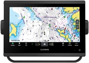


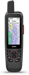

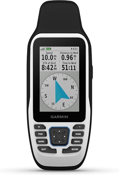
The renewed Garmin GPSMAP 79sc offers the same features and performance as the new model at a lower price point. As a certified refurbished unit, it has been tested and restored to like-new condition, making it an excellent value for budget-conscious boaters. The floating, water-resistant design with a high-resolution color display and scratch-resistant, fogproof glass makes it suitable for harsh marine environments.
We may earn a commission when you buy through this link, at no additional cost to you.
Preloaded BlueChart g3 coastal charts provide detailed coverage of US coastal waters, which is ideal for inshore and near-shore navigation. The unit supports multiple satellite constellations (GPS, GLONASS, Beidou, Galileo, QZSS, and SBAS) for reliable tracking around the world. The built-in 3-axis tilt-compensated electronic compass shows heading while standing still, and the barometric altimeter tracks pressure changes.
With increased memory for 10,000 waypoints, 250 routes, and 300 fit activities, you can store extensive navigation data. The 20-hour battery life in GPS mode is excellent for a handheld unit. The ability to float is a critical safety feature that can prevent loss of the device in the event of an accidental drop.
Certified refurbished units like the renewed GPSMAP 79sc offer significant savings compared to new models while providing the same features and performance. These units have been thoroughly tested, repaired if necessary, and restored to like-new condition. They typically come with a warranty, providing peace of mind. For budget-conscious boaters, renewed units can be an excellent way to get premium features at a lower price, especially when the original model’s specifications meet all your needs.
The main trade-offs are the renewed/refurbished condition and the small 2.6-inch display. For boaters who want the features of the GPSMAP 79sc at a lower price, however, the renewed version offers excellent value and the same reliable performance, making it a smart choice for budget-conscious buyers who still want premium features.
Not ideal for buyers who prefer new equipment or need a large display.
We may earn a commission when you buy through this link, at no additional cost to you.
For boaters who need a reliable handheld GPS that won't sink if dropped overboard, the Garmin GPSMAP 79sc offers rugged construction with a floating design. Its IPX6 water resistance and scratch-resistant, fogproof glass make it suitable for harsh marine environments. The ability to float is a critical safety feature that can prevent loss of an expensive device in the event of an accidental drop.
We may earn a commission when you buy through this link, at no additional cost to you.
The unit supports multiple satellite constellations (GPS, GLONASS, Beidou, Galileo, QZSS, and SBAS) for reliable tracking around the world. Preloaded BlueChart g3 coastal charts provide detailed coverage of US coastal waters, which is ideal for inshore and near-shore navigation. The built-in 3-axis tilt-compensated electronic compass shows heading even when standing still, and the barometric altimeter tracks pressure changes to help predict weather.
With increased memory for 10,000 waypoints, 250 routes, and 300 fit activities, you can store extensive navigation data for frequent trips and favorite spots. The 20-hour battery life in GPS mode is impressive for a handheld unit, ensuring you can rely on it for full days on the water. The high-resolution color display, while small, is readable in most conditions.
For marine use, a GPS that floats can be the difference between retrieving a dropped device and losing it forever. The GPSMAP 79sc’s floating design, combined with IPX6 water resistance, provides peace of mind in rough conditions or when handling the unit on a moving boat. This is particularly valuable for handheld units that are more likely to be dropped than fixed-mount displays.
The main trade-offs are the small display size and lack of sonar capabilities. For boaters who want a reliable, floating handheld GPS with comprehensive satellite support and coastal chart coverage, however, the GPSMAP 79sc is an excellent choice for backup navigation or as a primary unit on smaller boats.
Not ideal for buyers who need a large display or integrated sonar/fish-finding capabilities.
We may earn a commission when you buy through this link, at no additional cost to you.
The Simrad GO Chartplotter is designed for boaters who want a single display that can handle navigation, fish finding, and radar without the complexity of multiple dedicated units. Its 9-inch multifunction display is perfect for sportboats, center-consoles, and smaller cruisers that need comprehensive functionality in a compact package. The ability to add radar and sonar capabilities makes it one of the most versatile chartplotters available.
We may earn a commission when you buy through this link, at no additional cost to you.
The included C-MAP DISCOVER card provides full-featured vector charts with custom depth shading, tides and currents, and high-resolution bathymetric contours. This gives you detailed information about the underwater environment that goes beyond standard navigation charts. The 83/200 kHz HDI transducer supports clear CHIRP sonar and DownScan Imaging to help identify bottom structure and fish targets, making it a capable fish finder as well as a navigation tool.
Built-in GPS with Wi-Fi and NMEA 2000 support enables seamless system integration with other marine electronics. The built-in connectivity allows you to mirror your display to a smartphone or tablet, giving you access to charts, radar, and other functionality from anywhere on board. This is particularly useful for monitoring your position or fish finder while moving around the boat, or for sharing information with crew members.
Having navigation, sonar, and radar on a single display reduces clutter on your helm, makes it easier to correlate information between systems, and can be more cost-effective than buying separate units. For boats with limited space, a multifunction display like the Simrad GO allows you to start with basic navigation and add capabilities like sonar and radar as your needs and budget grow.
The main trade-offs are the higher price point and the fact that radar capability requires a separate purchase. For boaters who want a single display that can grow with their needs and serve multiple purposes, however, the Simrad GO provides one of the most flexible and capable platforms available.
Not ideal for buyers who want a simple, dedicated GPS without multifunction capabilities or those on a tight budget.
We may earn a commission when you buy through this link, at no additional cost to you.
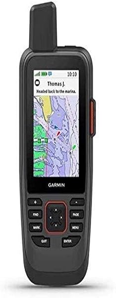
The Garmin GPSMAP 86Sci stands out as the only handheld in this comparison with built-in InReach satellite communication capabilities. This makes it ideal for boaters who venture into areas without cellular coverage or need reliable emergency communication. The floating, water-resistant design with a sunlight-visible 3-inch display ensures it can handle marine conditions.
We may earn a commission when you buy through this link, at no additional cost to you.
Preloaded BlueChart G3 coastal charts include the best of Garmin and Navionics data, providing comprehensive coverage for coastal navigation. The ability to stream boat data from compatible chartplotters and instruments lets you consolidate your marine system information on a single device. It can even function as a remote control for Garmin autopilot and Fusion Marine products, adding convenience to your helm setup.
With a satellite subscription, you can send and receive two-way text messages via the 100% Global Iridium satellite network, trigger an interactive SOS to the 24/7 search and rescue monitoring center, and share your location with others using GPS-based location tracking. The adjustable GPS filter smooths speed and heading indications over swells for more stable readings in rough conditions.
In areas without cellular coverage, satellite communication can be the only way to call for help in an emergency. The GPSMAP 86Sci’s InReach capabilities provide global coverage through the Iridium network, allowing you to send SOS signals and communicate via text message from virtually anywhere on the planet. This makes it particularly valuable for offshore boaters, long-distance cruisers, or anyone who ventures into remote areas where traditional communication methods fail.
The main trade-offs are the requirement for a satellite subscription to use the InReach features and the smaller 3-inch display. For boaters who prioritize safety and communication in remote areas, however, the GPSMAP 86Sci provides unique capabilities that can be lifesaving in emergency situations.
Not ideal for buyers who don’t need satellite communication or prefer a larger display.
We may earn a commission when you buy through this link, at no additional cost to you.
The Garmin GPSMAP 79s is a versatile handheld GPS designed for boaters who need global coverage without the higher cost of preloaded detailed charts. Its rugged, floating, water-resistant design with a high-resolution color display and scratch-resistant, fogproof glass makes it suitable for harsh marine environments. The ability to float is a critical safety feature that can prevent loss of the device.
We may earn a commission when you buy through this link, at no additional cost to you.
The unit supports multiple satellite constellations (GPS, GLONASS, Beidou, Galileo, QZSS, and SBAS) for reliable tracking around the world. The worldwide basemap provides basic coverage globally, and you can add more detailed charts as needed. The built-in 3-axis tilt-compensated electronic compass shows heading while standing still, and the barometric altimeter tracks pressure changes to help predict weather.
With increased memory for 10,000 waypoints, 250 routes, and 300 fit activities, you can store extensive navigation data for frequent trips and favorite spots. The 20-hour battery life in GPS mode is excellent for a handheld unit. The ability to float is a critical safety feature that can prevent loss of the device in the event of an accidental drop.
A worldwide basemap provides basic global coverage, which is valuable for boaters who travel to different regions or need a backup navigation device that works anywhere. While it lacks the detail of specialized coastal or inland charts, it ensures you always have at least basic navigation information available, regardless of where your adventures take you. This makes it ideal for international boaters or those who frequently visit new areas.
The main trade-offs are the lack of preloaded detailed charts and the small 2.6-inch display. For boaters who want a reliable, floating handheld GPS with global satellite support and the flexibility to add charts as needed, however, the GPSMAP 79s is an excellent choice for backup navigation or international use.
Not ideal for buyers who need detailed preloaded charts for their primary boating areas.
We may earn a commission when you buy through this link, at no additional cost to you.
The Garmin ECHOMAP UHD2 94sv is a premium chartplotter designed for serious anglers and boaters who demand the best in both navigation and fish-finding. The 9-inch touchscreen display is bright and readable even in direct sunlight, with improved detail, clarity, and viewing angle compared to previous models. This makes it ideal for open-water fishing where visibility is crucial.
We may earn a commission when you buy through this link, at no additional cost to you.
The included GT56-TM transducer supports Garmin traditional, ClearVü, and SideVü scanning sonars, giving you comprehensive underwater imaging capabilities. Built-in Garmin Navionics+ coastal charts with integrated Navionics data provide detailed coverage of US coastal waters. This combination makes it ideal for both navigation and fishing in saltwater environments.
Built-in Wi-Fi connectivity lets you wirelessly share sonar data, waypoints, and routes with another compatible ECHOMAP UHD2 chartplotter. You can also wirelessly connect to your Force trolling motor to create and follow routes, navigate to waypoints, control speed, and check battery life, streamlining your fishing workflow and improving efficiency on the water.
UHD2 (Ultra High Definition) sonar provides significantly clearer and more detailed images than standard CHIRP technology. This enhanced resolution makes it easier to distinguish between fish, bait, and structure, and can help you identify specific species based on their sonar signatures. For serious anglers, this improved clarity can be the difference between a good day and a great day on the water, especially when targeting specific species or fishing in complex environments.
The main trade-offs are the premium price point and the fact that touchscreens can be more challenging to use in rough conditions or when wearing gloves. For anglers who want top-tier performance in both navigation and fish-finding, however, the ECHOMAP UHD2 94sv is one of the best all-around chartplotters available.
Not ideal for buyers on a tight budget or those who prefer traditional keyed interfaces over touchscreens.
We may earn a commission when you buy through this link, at no additional cost to you.
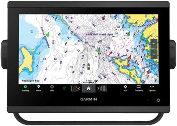
The Garmin GPSMAP 943xsv represents the pinnacle of Garmin's chartplotter technology, offering ultra high-definition scanning sonar for exceptional underwater imaging. This makes it ideal for serious anglers who demand the best possible fish-finding capabilities. The Panoptix sonar support allows for real-time, 3D imaging that shows you what is happening beneath and around your boat in ways that traditional 2D sonar cannot match.
We may earn a commission when you buy through this link, at no additional cost to you.
Pre-loaded mapping ensures you have access to detailed chart data from the start. Improved display optics provide better visibility in various lighting conditions. The combination of advanced sonar and high-quality mapping makes this one of the most capable fish-finding chartplotters available, with the ability to see fish and structure in exceptional detail.
The premium build quality ensures reliable performance in marine environments. This chartplotter is designed for boaters who want the absolute best in sonar technology and are willing to pay for it. The ability to see fish and structure in such detail can significantly improve your fishing success, especially in challenging conditions or when targeting specific species.
Panoptix sonar provides real-time, 3D imaging that shows you what is happening beneath and around your boat in ways that traditional 2D sonar cannot. This allows you to see fish swimming in real-time, watch how they react to your lure, and get a more complete picture of the underwater environment. For serious anglers, this can significantly improve your ability to locate and catch fish, especially in complex or feature-rich waters where understanding fish behavior is crucial.
The main trade-offs are the very high price point and the fact that a transducer is not included, which adds to the overall cost. For serious anglers who want the most advanced sonar capabilities available, however, the GPSMAP 943xsv delivers professional-grade performance that can transform your fishing experience.
Not ideal for buyers on a budget or those who don’t need the most advanced sonar capabilities.
We may earn a commission when you buy through this link, at no additional cost to you.
The Garmin GPS 73 is designed for budget-conscious boaters who need basic marine navigation without the high cost of premium chartplotters. Its 2.6-inch display is compact and easy to use, making it ideal for small boats, kayaks, or as a backup navigation device. The very affordable price makes it accessible for virtually any boater, from weekend anglers to casual sailors.
We may earn a commission when you buy through this link, at no additional cost to you.
Special sailing features include a virtual starting line, countdown timers, speed history, and tack assist, making it particularly valuable for sailors. Marine-specific features include MOB (Man Overboard), marine alarms (off course, anchor drag, etc.), route planning, and navigation. The intuitive user interface with dedicated backlit buttons provides quick and easy operation, even in low-light conditions.
The long battery life of 18+ hours on just 2 AA batteries ensures you can rely on it for extended trips. It stores up to 1,000 waypoints and 100 tracks, which is adequate for most recreational boaters. The included lanyard and quick start manual make it ready to use out of the box, with minimal setup required.
The GPS 73’s sailing-specific features like virtual starting lines, countdown timers, and tack assist are designed to help sailors optimize their performance. These features can be particularly valuable for competitive sailors or anyone who wants to improve their sailing efficiency. Even recreational sailors can benefit from the specialized functionality, which provides information and tools tailored to the unique needs of sailing.
The main trade-offs are the small 2.6-inch display and the lack of preloaded charts, which means you will need to purchase additional chart data for detailed navigation. For boaters who want a simple, affordable marine GPS with essential features, however, the GPS 73 is one of the best values available.
Not ideal for buyers who need detailed preloaded charts or a large display.
We may earn a commission when you buy through this link, at no additional cost to you.
The Garmin ECHOMAP UHD2 54CV is designed for boaters who want quality chartplotting and fish-finding capabilities in a compact, affordable package. The 5-inch keyed display is bright and easy to read, making it ideal for smaller boats, kayaks, or as a secondary display on larger vessels. The keyed interface provides tactile feedback that many boaters prefer in rough conditions or when wearing gloves.
We may earn a commission when you buy through this link, at no additional cost to you.
You get double the views with Garmin CHIRP traditional and ClearVü scanning sonars, providing both standard fish-finding and detailed downward imaging. The high-contrast vivid color palettes make underwater images pop, helping you identify fish and structure more easily. Preloaded with LakeVü g3 maps, you have access to detailed inland water data that is particularly valuable for freshwater fishing.
Wi-Fi connectivity between compatible chartplotters makes it easy to share information like waypoints, routes, and sonar data. The compact size makes it easy to find a mounting location, even on boats with limited helm space. This is an excellent choice for freshwater fishing and inland navigation, offering a good balance of features and affordability.
ClearVü scanning sonar provides near-photographic images of what is beneath your boat, making it easier to identify fish, structure, and bottom composition. This is particularly valuable for freshwater fishing where you are often targeting specific species that relate to particular structures like weed beds, drop-offs, or submerged timber. The detailed images can help you pattern fish more effectively and improve your catch rates on inland waters.
The main trade-offs are the smaller 5-inch screen, which may be harder to read for some users, especially when viewing detailed charts or sonar images, and the lack of SideVü capability. For boaters who want a compact, feature-packed chartplotter for inland waters, however, the ECHOMAP UHD2 54CV offers excellent value and performance.
Not ideal for buyers who need a larger display, SideVü sonar for side scanning, or coastal chart coverage.
We may earn a commission when you buy through this link, at no additional cost to you.
The Humminbird Helix 5 Chirp GPS G3 is designed for freshwater anglers who want advanced fish-finding capabilities at a reasonable price. Its Dual Spectrum CHIRP sonar delivers views of fish arches and fish-holding structure with two ways to search: Wide Mode for maximum coverage and Narrow Mode for detailed scanning. This versatility makes it ideal for various fishing techniques and water conditions, from open water to heavy cover.
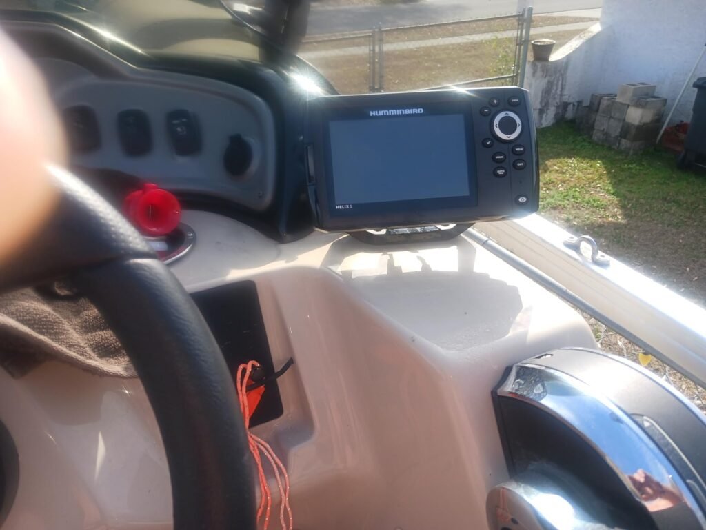
We may earn a commission when you buy through this link, at no additional cost to you.
Equipped with Humminbird Basemap, it includes coverage of 10,000+ lakes and continental U.S. coastlines. The Real-Time Mapping feature with AutoChart Live creates maps of depth contours, bottom hardness, and vegetation while boating, with eight hours of built-in recording time. This allows you to build custom maps of your favorite fishing spots, which can reveal new structure and productive areas.
Compatible with premium LakeMaster, CoastMaster, and Navionics charts for expanded coverage and detail. The reliable keypad control with a user-friendly menu system operated by softkey controls ensures reliable operation in any weather conditions. Access pre-loaded views and settings through the intuitive button interface, which many anglers prefer over touchscreens for fishing applications.
Dual Spectrum CHIRP provides two distinct sonar modes: Wide Mode for maximum coverage and Narrow Mode for detailed scanning. This flexibility allows you to adjust your sonar to match the fishing conditions and your target species. Wide Mode is ideal for covering large areas quickly when searching for fish, while Narrow Mode provides the detailed resolution needed to identify individual fish and fine structure in heavy cover or complex environments.
The main trade-offs are the lack of preloaded premium charts and the smaller 5-inch display. For freshwater anglers who want advanced CHIRP sonar and real-time mapping capabilities, however, the Helix 5 Chirp GPS G3 offers excellent performance and value, making it a smart choice for serious inland fishing.
Not ideal for buyers who need preloaded premium charts or saltwater coverage.
We may earn a commission when you buy through this link, at no additional cost to you.
The best marine GPS for you depends on your boat size, typical boating areas, budget, and what features matter most for your style of navigation. This section breaks down the key factors to help you make an informed decision that matches your real needs on the water.
Display size is one of the most important considerations, as it directly affects how much information you can view at once and how easily you can read it in various conditions. Marine GPS units in this comparison range from compact 2.6-inch handheld displays to large 9-inch chartplotters. Larger displays like those on the Garmin ECHOMAP UHD2 94sv and GPSMAP 943xsv provide more screen real estate for viewing detailed charts, sonar images, and other data simultaneously, but they also require more helm space and come with higher price tags.
Display type also matters. Touchscreen displays like the ECHOMAP UHD2 94sv offer intuitive operation and can display more information, but may be harder to use in rough conditions or when wearing gloves. Keyed displays like those on the ECHOMAP UHD2 54CV and Garmin GPS 73 provide tactile feedback that many boaters prefer for reliability in challenging conditions. Consider your typical boating environment and personal preferences when choosing between display types.
Choose a display size based on your available helm space and how you plan to use the GPS. Larger boats with ample space benefit from bigger displays, while smaller boats and handheld units are better served by compact screens.
Preloaded chart coverage varies significantly between models and is one of the most important factors for navigation. Some marine GPS units come with comprehensive preloaded maps for specific regions, while others include only a basic worldwide basemap that requires you to purchase additional charts. The Garmin ECHOMAP models typically include Navionics+ charts for specific regions, with the UHD2 94sv including coastal charts and the 54CV including inland mapping.
The Simrad GO Chartplotter includes a C-MAP DISCOVER card with full-featured vector charts, custom depth shading, tides and currents, and high-resolution bathymetric contours. The Garmin GPSMAP 943xsv and GPSMAP 79sc include preloaded BlueChart g3 coastal charts, while the GPSMAP 79s includes a worldwide basemap. Consider the waters you typically navigate and ensure your GPS has appropriate coverage for those areas.
For most boaters, having preloaded charts for your primary operating area is the most practical approach. If you travel to different regions, look for models with expandable chart capabilities or the ability to add additional map data.
GPS accuracy affects how precisely your marine GPS can determine your position, which is crucial for navigation, marking waypoints, and returning to productive fishing spots. Most modern marine GPS units use high-sensitivity GPS receivers, but some models offer enhanced accuracy through support for multiple satellite constellations. The Garmin GPSMAP 79sc, 79s, and 86Sci all support GPS, GLONASS, Beidou, Galileo, QZSS, and SBAS, providing reliable tracking around the world.
GPS performance also affects how quickly your unit can acquire a signal and maintain it in difficult conditions. Models with support for multiple satellite constellations typically provide more consistent performance, especially in areas with poor satellite visibility or when moving at high speeds. For most recreational boaters, standard GPS is sufficient, but serious navigators and offshore anglers may benefit from enhanced satellite support.
Consider the type of boating you do. For coastal and offshore navigation, prioritize models with multi-constellation support. For inland fishing and casual use, standard GPS is usually adequate.
Marine environments are harsh, with exposure to saltwater, UV rays, temperature extremes, and the ever-present risk of drops overboard. Water resistance and floatability are crucial for ensuring your marine GPS can withstand these conditions. The Garmin GPSMAP 79sc, 79s, and 86Sci all feature IPX6 water resistance and floating designs, which are critical safety features for handheld units.
For fixed-mount chartplotters like the Simrad GO and Garmin ECHOMAP series, water resistance is typically built into the design for marine use. However, the level of protection can vary between models. Look for units with robust construction and marine-grade materials. The ability to float is particularly valuable for handheld units, as it can prevent the loss of an expensive device if it is accidentally dropped overboard.
Consider where and how you will use your marine GPS. For handheld units, floatability and high water resistance are must-have features. For fixed mounts, ensure at least IPX6 rating for protection against water ingress.
Battery life is particularly important for handheld marine GPS units, as it determines how long you can use the device between charges. The Garmin GPSMAP 79sc, 79s, and 86Sci all offer up to 20 hours of battery life in GPS mode, which is excellent for handheld units. The Garmin GPS 73 provides 18+ hours on just 2 AA batteries, making it particularly convenient for extended trips.
For fixed-mount chartplotters, power is typically drawn from your boat’s 12V electrical system, so battery life is less of a concern. However, you should ensure that your boat’s electrical system can handle the power requirements of your GPS and any connected accessories. Some models may have higher power demands, especially those with large displays or advanced features.
Consider your typical trip length and whether you will have access to charging. For handheld units, prioritize long battery life. For fixed mounts, ensure compatible power sources.
Navigation features vary between marine GPS units and can significantly impact their usefulness for different applications. Basic handheld units like the Garmin GPS 73 and GPSMAP 79s provide essential navigation with waypoint storage, route planning, and marine alarms. More advanced models like the Garmin GPSMAP 86Sci add features like boat data streaming, remote autopilot control, and satellite communication.
Waypoint management is crucial for marking productive fishing spots, navigation hazards, and points of interest. The Garmin GPSMAP 79sc and 79s offer increased memory for 10,000 waypoints, 250 routes, and 300 fit activities. The Garmin ECHOMAP UHD2 series can wirelessly share waypoints and routes between compatible units, making it easy to coordinate with fishing partners or share information across multiple displays.
Consider your typical navigation needs. For simple waypoint marking and basic navigation, most units will suffice. For complex route planning and extensive waypoint management, prioritize models with more memory and advanced features.
Sonar capabilities are crucial for anglers and can vary from basic fish-finding to advanced imaging systems. Traditional CHIRP sonar provides excellent fish detection and depth information. ClearVü and SideVü scanning sonars, found on models like the Garmin ECHOMAP UHD2 series, provide detailed downward and side images of underwater structure and fish. The Garmin GPSMAP 943xsv includes ultra high-definition scanning sonar and Panoptix support for real-time 3D imaging.
UHD2 (Ultra High Definition) sonar, available on the ECHOMAP UHD2 models, provides significantly clearer and more detailed images than standard CHIRP. This enhanced resolution makes it easier to distinguish between fish, bait, and structure. The Humminbird Helix 5 features Dual Spectrum CHIRP with Wide and Narrow modes for different fishing scenarios. The Simrad GO Chartplotter includes an HDI transducer with CHIRP and DownScan Imaging.
Consider your fishing style and the type of water you typically fish when choosing sonar capabilities. For serious anglers, advanced sonar features can significantly improve your success on the water.
Connectivity options determine how your marine GPS can integrate with other devices and systems. Wi-Fi connectivity, available on the Garmin ECHOMAP UHD2 series, allows for wireless sharing of sonar data, waypoints, and routes between compatible chartplotters. This is particularly useful for boats with multiple displays or for sharing information with fishing partners. The ECHOMAP UHD2 series can also connect to Force trolling motors for integrated control.
NMEA 2000 connectivity, found on the Simrad GO Chartplotter, allows for seamless integration with other marine electronics like radar, autopilot systems, and engine monitors. Some models like the Garmin GPSMAP 86Sci can stream boat data from compatible chartplotters and instruments, consolidating your marine system information on a single device. Mobile connectivity allows you to mirror your display to a smartphone or tablet, as with the Simrad GO Chartplotter.
Consider what other electronics you have or plan to add to your boat. For comprehensive integration, prioritize models with multiple connectivity options. For simple setups, basic connectivity may be sufficient.
Durability is particularly important for marine use, where your GPS may be subjected to saltwater, UV rays, temperature extremes, and vibration. Most marine GPS units in this comparison are designed for marine environments with water-resistant construction, but the level of protection can vary. The Garmin GPSMAP series is known for its rugged construction and reliable performance in challenging conditions.
Handheld units like the Garmin GPSMAP 79sc, 79s, and 86Sci feature IPX6 water resistance and floating designs, making them suitable for harsh marine environments. Fixed-mount chartplotters like the Simrad GO and Garmin ECHOMAP series feature marine-grade construction designed for the demands of boating. For offshore use or exposed installations, prioritize models with the highest level of weather protection.
Consider where you will use your marine GPS and the conditions it will be exposed to. For protected installations, standard marine construction is usually sufficient. For exposed or offshore use, prioritize the most durable models available.
Marine GPS units come in different form factors designed for different use cases. Handheld units like the Garmin GPSMAP 79sc, 79s, 86Sci, and GPS 73 offer maximum portability and can be used in multiple boats, carried on land, or taken on small craft like kayaks. Fixed-mount chartplotters like the Simrad GO and Garmin ECHOMAP series are designed for permanent installation on your boat’s helm.
Portability often comes with trade-offs. Handheld units typically have smaller displays and may lack advanced features like sonar or large chart storage. Fixed-mount units provide better performance and more features but require permanent installation. The Garmin GPSMAP 86Sci bridges the gap somewhat with its ability to stream boat data from compatible chartplotters, providing some fixed-mount capabilities in a handheld form factor.
Consider your primary use case. For travel between boats, temporary use, or small craft, prioritize portability. For permanent installation on a primary vessel, fixed mounts provide better performance and features.
Start by carefully reading the manual and familiarizing yourself with your marine GPS’s features and controls. For handheld units, test the device before your trip to ensure it is functioning properly and that you understand the basic operations. For fixed-mount chartplotters, plan your installation location carefully, ensuring the display is visible from the helm, protected from the elements as much as possible, and positioned where it won’t interfere with other controls.
When installing a fixed-mount unit, use appropriate mounting hardware and ensure all connections are secure and waterproof. For chartplotters with sonar capabilities, install the transducer according to the manufacturer’s instructions, typically mounted on the transom or through-hull, and ensure it is properly aligned for optimal performance. Check that your GPS is acquiring a signal and that your position is accurate on the chart before setting out.
Regular maintenance includes cleaning the display with a soft, damp cloth and mild soap, checking all connections for corrosion or damage, and ensuring the transducer is free of marine growth. Update your chart data periodically to ensure you have the most current information. For best performance, keep your software up to date with the latest firmware from the manufacturer. Before each trip, verify that all systems are functioning properly, including GPS, sonar, and any connected accessories.
While smartphone GPS can provide basic positioning, dedicated marine GPS units offer several critical advantages. They have larger, sunlight-readable displays that are easier to view in bright conditions. They include specialized marine charts with detailed depth information, navigation aids, and other data crucial for safe boating. Marine GPS units are also water-resistant, have better GPS accuracy, and can integrate with other marine electronics like sonar and radar. For serious boating and fishing, a dedicated marine GPS is far superior to a smartphone for navigation and safety.
Handheld marine GPS units are portable, battery-powered devices that can be used in multiple boats, carried on land, or taken on small craft like kayaks. They are ideal for flexibility and temporary use. Fixed-mount marine GPS units are designed for permanent installation on your boat's helm, typically with larger displays and more advanced features. They require a power connection to your boat's electrical system. Fixed mounts generally offer better performance and more features but lack the portability of handheld units.
IPX6 is a rating that indicates the unit is protected against heavy seas or powerful jets of water. This means the device can withstand strong water spray from any direction without harmful effects. IPX6-rated devices like the Garmin GPSMAP 79sc, 79s, and 86Sci are suitable for use in harsh marine environments where they may be exposed to rain, spray, or splashes. However, IPX6 does not mean the device is fully submersible, so you should still avoid dropping it in the water.
Chart updates vary by brand and model. Garmin marine GPS units typically allow you to update charts via SD card or through the Garmin ActiveCaptain app. Some models support wireless updates through Wi-Fi connectivity. Regular chart updates ensure you have the most current information about depth contours, navigation aids, and other important data. Check your marine GPS's manual for specific update procedures and recommended update frequency. Many manufacturers offer annual chart update subscriptions.
Absolutely. Many boaters use their marine GPS primarily for fishing. Modern marine GPS units with sonar capabilities can help you locate fish, identify underwater structure, and find productive fishing spots. Features like CHIRP, ClearVü, and SideVü sonar provide detailed images of what is beneath and around your boat. The ability to mark waypoints, create routes, and track your position also helps you return to productive spots and navigate to new fishing locations. Many units also include fishing-specific features like fish alarms and depth contours.
CHIRP (Compressed High-Intensity Radar Pulse) sonar uses a continuous sweep of frequencies to create a more detailed and accurate image of what is beneath your boat compared to traditional single-frequency sonar. CHIRP provides better target separation, clearer images, and more consistent performance across different depths. Traditional sonar uses a single frequency, which can be less detailed and more susceptible to interference. Most modern marine GPS units with sonar use CHIRP technology for superior fish-finding capabilities.
Battery life varies between handheld marine GPS units. The Garmin GPSMAP 79sc, 79s, and 86Sci all offer up to 20 hours of battery life in GPS mode, which is excellent for extended trips. The Garmin GPS 73 provides 18+ hours on just 2 AA batteries. Battery life can be affected by factors like temperature, usage of backlight, and satellite signal strength. For most recreational boaters, these battery lives are sufficient for a full day on the water. Always carry spare batteries or a charging solution for longer trips.
Multi-constellation support provides more reliable tracking and faster signal acquisition, especially in challenging conditions. The Garmin GPSMAP 79sc, 79s, and 86Sci support GPS, GLONASS, Beidou, Galileo, QZSS, and SBAS. GPS is the primary constellation used worldwide. GLONASS is the Russian system that provides additional coverage. Beidou is China's system, Galileo is Europe's, and QZSS is Japan's regional system. SBAS provides correction signals for improved accuracy. For most boaters, GPS alone is sufficient, but multi-constellation support provides better performance in areas with poor GPS signal.
Yes, you can use a marine GPS on land, and many boaters do use their handheld units for hiking, hunting, or other land-based activities. Marine GPS units typically have excellent GPS receivers that work well on land, and many include features like barometric altimeters and electronic compasses that are useful for terrestrial navigation. However, the preloaded marine charts may not be as detailed or useful on land as dedicated topographic maps. For land use, you might want to consider a unit with both marine and land mapping capabilities.
Essential accessories for a marine GPS depend on the type of unit. For handheld units, consider a lanyard to prevent loss, a protective case, and spare batteries. For fixed-mount chartplotters, you will typically need a transducer for sonar capabilities, mounting hardware, and possibly a protective cover. Other useful accessories include external antennas for better GPS reception, memory cards for additional chart storage, and carrying cases for handheld units. Always ensure accessories are compatible with your specific marine GPS model.
The Garmin GPSMAP 86Sci earns the top overall spot for its unique combination of floating handheld design, InReach satellite communication capabilities, preloaded BlueChart G3 coastal charts, and the ability to stream boat data from compatible chartplotters. For boaters who prioritize safety, communication, and flexibility in a portable package, it provides capabilities that can be lifesaving in emergency situations while also serving as a reliable navigation tool for everyday use.
Buyers with different priorities have strong alternatives. The Garmin GPSMAP 943xsv is the clear choice for serious anglers who want the most advanced sonar capabilities with ultra high-definition scanning and Panoptix support. The Garmin GPS 73 offers the best value for budget-conscious buyers who want essential marine features at an affordable price. The Simrad GO Chartplotter provides the best multifunction option with radar and sonar capabilities, while the Garmin ECHOMAP UHD2 94sv delivers a premium touchscreen experience with excellent sonar performance.
Start by identifying your primary use case: safety and communication, advanced fish-finding, budget-friendly navigation, or multifunction capabilities. Then match display size, chart coverage, satellite support, and special features to your actual boating needs. For offshore use, prioritize satellite communication and advanced GPS capabilities. For fishing, focus on sonar features and chart coverage. For budget-conscious buyers, consider renewed units or basic models that still provide essential navigation. With the right marine GPS, you can navigate with confidence and safety on any body of water.